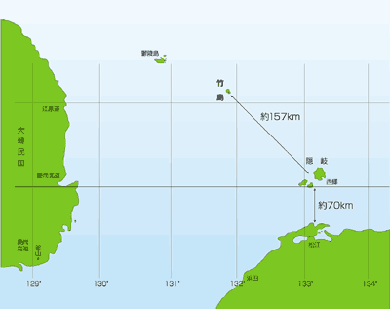
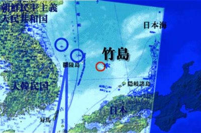
 太政官決定前の1875年に日本の陸軍参謀局が作製した「亜細亜東部輿地図」(国立公文書館所蔵)の複写。左上に竹島と松島の記載があるものの、現在の竹島の位置には何の記載もない/1875 map that was made before 1877 daojoukan decision. On the upper left, "takeshima" and "matsuhima are written, but there is nothing at the place of the present Dokdo/Takeshima
日韓両国が領有権を主張する竹島(韓国名・独島)問題で、明治政府の最高機関だった太政官が「竹島(現在の鬱陵島)と、ほか一島は日本と関係なし」とする内容を記載した1877年の太政官の決定文書について、島根県が設けた竹島問題研究会の座長を務める下條正男・拓殖大教授が、政府が無関係とした中に、現在の竹島は含まれていない、とする見解を明らかにした。
韓国側は「竹島と、ほか一島」を鬱陵島と現在の竹島と位置づけ、「日本政府が竹島を日本領土ではないと認めていた」として自国領とする根拠の一つに挙げており、その主張に反論する見解として注目を集めそうだ。
下條氏は先ごろ開かれた研究会で、「太政類典」に収録されている太政官の決定に関する文書を示し、現在の鬱陵島を示す竹島と、松島の記述に着目。竹島に住む動植物などが紹介されているのに続き、隠岐諸島から竹島に向けた同一線上に松島という島があり、米子の商人の大谷家が越後(新潟県)からの帰りに日本海で遭難して漂着したのが、この島(松島)であった、と記していることを明らかにした。
だが、大谷家に関する文書では、漂着したのは現在の鬱陵島としており、下條氏は「太政官決定の文書にある竹島と松島は、ともに現在の鬱陵島のことが書かれている。当時の政府発行の地図には、現在の竹島の位置に何の記載もなく、竹島と松島が描かれていることから、太政官は、この二つの島は関係なし、としたにすぎない」と指摘。
「現在の竹島にも触れていない文書を論拠とし、『ほか一島』を現在の竹島とする韓国側の主張には根拠はない」と、韓国側の文献解釈の問題点を明らかにした。山陰中央新聞
http://www.dokdo-takeshima.com/Usando-songdo-doc.jpg
The first link forgmouth provides is a document titled 松島巡視要否ノ議 (Regarding the Need for an Inspection Mission to Matsushima), and was written in 1878. It is a paper submitted by TANABE Taichi of the Foreign Ministry stating his opinion against an inspection to Matsushima. He says that Matsushima is Usan, and since Usan is part of Ulleungdo, then it is a part of Chosun, and so any inspection mission would cause unnecessary friction from Chosun regardless of the motive. It is just one side of the debate that was going on. Unlike Korea, in Japan, there are usually pros and cons to any issue. The background for his opinion is the 1877 Dajyokanrei, the document Koreans love to site, which says that “Takeshima and one other island is not Japan’s territory (竹島外一島 本邦無関).” Koreans claim that the one other island is Dokto, but the appended map (http://toron.pepper.jp/jp/take/hennyu/haaa.html), which the Koreans ironically provided as evidence, repeatedly prints the name of Matsushima (“Matsushima is 80 ris to the NW of Fukuura, Oki” 隠岐後福浦ヨリ松島ヲ距ル乾位八十里許 and “Isotakeshima is 40ris NW of Matsushima” 松島ヨリ磯竹島ヲ距ル 乾位 四十里許). Thus, it naturally follows that Matsushima would have not gone unnamed in the document. Rather, the one other island most likely referred to Jukto on the northeast of Ulleungdo. After this 1877 ordinance, there was a debate in Japan as to the inspection of Matsushima in preparation for its incorporation should it be unowned since it was positioned in a strategically crucial location. The very fact that this debate took place also confirms that Japan did not forfeit Matsushima the year before in the 1877 ordinance. The situation at the time is summarized in the documents below:
International situation: The British Occupation of Komundo
http://www.geocities.com/juliancoy/komundo.htm
The Japanese situation: 松島之議 (Regarding Matsushima) by WATANABE Kouki of the Foreign Ministry in 1878
http://matsu.rcks.kyushu-u.ac.jp/p/study/08takeshima/siryo-list/matsusimanogi.html
Since all of you here can read the first one, I will summarize the second one. It says:
In the past, most records have dealt with Takeshima, but few have discussed Matsushima in depth. There is currently a heated debate over whether Takeshima and Matsushima are one island or two different islands, but none have been conclusive. The Tokugawa shogunate has determined that Takeshima is Ullengdo and is Chosun territory. Thus, if Matsushima is indeed Takeshima, then it is Chosun’s, if not, then we must claim it, since it is located at such a critical point in the Sea of Japan, as it lies between our land and the Port Lazareff and both British and Russian ships are passing by it frequently. Reviewing the records, Takeshima aka Argonaut is Chosun’s, and the island we originally called Takeshima is equivalent to Ulleungdo. Then it follows that what we call Matsushima must be the island called Hornet Rocks. However, the West seems to call the original Takeshima as Matsushima and have drawn another Takeshima. While all countries regard the Hornet Rocks as our land and display it as thus in their maps, their views of the Argonaut and Dagelet vary. We are not quite sure ourselves. Thus, there is a need to inspect it to determine their identity geographically. We should bring with us people who have been on Takeshima on the mission to confirm the identity of the islands. This matter must be dealt with immediatelytwo cent at occidentalism
2) The section on “The Japanese Inquiry of Ulleungdo Region’s History” misquotes the Japanese text. The portion in red should not end there but continue to include “ルカ”. Thus, the passage reads, “According to the general map of the eight provinces attached at the head of the 東国興地勝覧 (Korean document established in 1478), there are two islands off the coast of Kangwon-to. The one of the west is called Usan and the one of the east is called Uturyou. Do these islands correspond to the two islands we call Takeshima and Matsushima?”
東国興地勝覧巻首八道総図中江原道ノ海中ニ二島アリ西ヲ于山ト云ヒ東ヲ鬱稜ト云フ豈我乎謂竹島松島ノ二島ナルカ
So contrary to what the site says (“These are what we Japanese call Matsushima (Dokdo) and Takeshima” or “It is interesting to note with this document that although Usando was drawn on Ulleungdo’s wrong (West) side, Japanese were concious of this error and still considered Usando to be Matsushima.”), the Japanese are actually questioning the true identity of the islands and which islands they correspond to on Japanese maps.two cents at occidentalism
This is the original Japanese text of the 1877 Directive:
明治10年3月29日
大臣 岩倉具視の印
別紙内務省稟議の日本海内竹島外一島地籍編纂之件
右の件は元禄5年朝鮮人(安龍福-原著者)が入島以来、旧政府と該国
(朝鮮-原著者注)との往復の結果、本邦とは関係なしと聞き、申し立ての稟
議の趣旨を聞き、次のような指令を作成し、この件に対し稟議する。
指令案
稟議趣旨の竹島外一島の件に対して、本邦は関係なしと心得るものなり。
Translation:
March 29, 10th year of Meiji (1877)
Response to the request for decision regarding the establishment of territorial rights to Takeshima and one other island in the Sea of Japan brought in the appended document of the Ministry of Internal Affairs.
Hearing that the matter stated on the right has been settled as a result of correspondence between our old government and the government of the country concerned since the landing of a Korean in 1692, and has been declared not to be our territory, and hearing the purport of the request, we have created the following directive and make a decision on the matter.
Directive
On the matter of Takeshima and one other island in the purport of the request, it should be considered as not our territory.
So the question is, is the “one other island (外一島)” the present Takeshima, then known as Matsushima or the Liancourt Rocks? I do not think so, because in the original request and in the appended opinions, the name “Matsushima” is explicitly stated and so it would not have gone unnamed in the decision. A Korean newspaper “discovered” a Japanese
map (which was available on the Internet and common knowledge in Japan long before) and claims that it had been appended to the directive and is proof that the “one other island” is Matsushima (present Takeshima). Even on that map, the name Matsushima is clearly printed. Contrary to what they claim, the map gives us a hint on what the other unnamed island: Jukto.
Furthermore, what immediately followed after this 1877 Directive was a series of debate on what to do with Matsushima, which clearly would not have taken place had it been included in the directive as forfeited territory. Some, like Tanabe in 松島巡視要否ノ議 (1878), claimed that such in inspection would be mistaken for Japan having territorial ambitions on Korea, since Matsushima was an island belonging to ancient Usanguk of Chosun. Others, like Koki Watanabe (松島ノ議 1878) claimed that it is crucial for Japan to identify the island Matsushima, as if it indeed existed and was unclaimed, it could pose a serious national security threat in the future if taken by foreign countries (I think he had in mind the Russian occupation of Tsushima in 1861). Notice the debate was about the identity of Dagelet Island. The latter side prevailed, and an inspection mission by the Navy vessel Amagi was conducted in 1880. Now why did Japan have to identify Matsushima? Because western maps had confused the situation by mapping three island in the Sea of Japan, from nearest to Japan, the Liancourt Rocks (Hornet Island), Dagelet (Matsushima), and Argonaut (Takeshima). In Edo period Japan, the Liancourt Rocks had been called Matsushima and Ulleungdo had been called Takeshima. Finally, a Japanese inspection mission in 1880 concludes once and for all that Matsushima (Dagelet) is no other than the former Takeshima/Ulleungdo.
Now, as for the passage “Takeshima and Matsushima have both become Chosun territory (竹島 松島 朝鮮附属ニ相成候始末),” it appears in the 1870 document “Investigation on the disposition of diplomatic affairs with Chosun (朝鮮国交際始末内探書, 1870).
Original text:
竹島松島朝鮮附属ニ相成候始末
此儀ハ松島ハ竹島ノ隣島ニシテ
松島ノ儀ニ付、是迄掲載セシ書留モ無之、
竹島ノ儀ニ付テハ元禄度後ハ暫クノ間朝鮮ヨリ居留ノ為差遣シ置候処 当時ハ以前ノ如ク無人ト相成
竹木又ハ竹ヨリ太キ葭ヲ産シ人參等自然ニ生シ 其餘漁産モ相應ニ有之趣相聞ヘ候事
Translation:
Account of Takeshima and Matsushima both having become Chosun territory
This matter concerns Matsushima which is a neighboring island of Takeshima and for no records of which exists up to this date.
Takeshima has been inhabited by Koreans sent by the Chosun government for a while after the Genroku incident [Note: Ahn Yong-bok incident], but since then have become uninhabited as before.
I hear that its produces are bamboo, lumber and reeds thicker than bamboo and that gingseng and other plant products grow naturally on the island. Marine products are fairly abundant.
Note how the document says that there are no records of Matsushima in Japan. If this author had meant the Matsushima/Liancourt Rocks/present Takeshima, then he would have found historical records of it. The Liancourt Rocks have been drawn on Japanese maps as Matsushima since the Edo period, and the shogunate had granted the Otani family development rights of Matsushima, so the “no records” doesn’t make sense. It does make sense if the author had been talking about the Matsushima/Dagelet. There are no records of such a large island between the Liancourt Rocks and Takeshima/Ulleungdo. The Japanese, seeing a western map with three islands, would naturally have been confused to see a large Matsushima/Dagelet between the Liancourt Rocks and Takeshima/Argonaut, the latter which we knew as Takeshima or Ulleungdo in the Edo period. They would have become even more confused since maps like the 1867 KATSU Kaishu map (大日本沿海略図, enlarged on bottom
here) clearly showed that Matsushima/Dagelet was more like the Takeshima/Ulleungdo we knew. Basically, this 1867 map was the start of the whole debate over the identity of Takeshima and Matsushima (Argonaut and Dagelet) in Japan, which was settled in 1880.
The fact that Japan forgot to officially incorporate Takeshima until 1905 shows that neither the identity nor the ownership of Liancourt Rocks was even being questioned during these debates, since “All foreign maps show the Hornet Rocks as belonging to us (而テ此ホルネットロックスノ我国ニ属スルハ各国ノ地図皆然リ-松島ノ議1878).”
http://matsu.rcks.kyushu-u.ac.jp/p/study/08takeshima/siryo-list/matsusimanogi.html
two cents at occidentalism松島巡見に関する論議について、外務省公信局長田辺太一は、次のように報じている。
松島巡視要否ノ議 公信局長 田辺太一
公云壱日開否ノ略定リテ而後今日視察ノ要否ヲ論スヘシ 聞クカ如キハ松島ハ我法人ノ命ゼル名ニシテ其実ハ朝鮮蔚陵島ニ属スル于山ナリ 蔚陵島ノ朝鮮ニ属スルハ旧政府ノ時一葛藤ヲ生シ文書往復ノ末永ク証テ我有トセラルヲ約シ載テ両国ノ史ニ在リ 今故ナク人ヲ遣テコレヲ巡視セシム 此ヲ他人ノ宝ヲ数フトイフ 況ンヤ跡隣境ヲ侵越スルニ類シ我ト韓トノ交漸ク緒ニ就クトイヘトモ猜嫌猶末永ク除カサルニ際シ如此一挙ヨリシテ再ヒ一隙ヲ開カンコト尤交際家ノ忌ム所ニ出ツルオヤ 仮令該島ヲシテ韓籍ニ属セストモ南無人島ヲ開キ琉球ヲ藩トスルモ識者或ハ其宜ニ非サルヲ論ス 現今ノ務方ニ国脈ヲ静養スルニアリ 鮮ヲ煎テコレヲ擾ス 計ノ得ルモノナラス 松島断シテ開ク能ワス 又開クヘカラス 其不能不可ヲ知テコレヲ巡視スル豈無益ナラサランヤ 況ヤ後害ヲ醸サントスルオヤ 乙云開否ノ略ハ視察ノ後ニ非サレハ定ムル能ハス 版図ノ論今其実ヲ視ス 只ニ蠧紙上ニ拠信スルハコレヲ可トイフヘカラス 況ンヤ我近海ニアリ 我民ノ韓ノ内地ニ航スルモノ露ノ藩地ニ航スルモノ必由ノ途タレハ其地ノ状形ヲ悉サスシテコレヲ不問ニ措ク我吾務ヲ尽ササルニ幾シ 故ニ該島ハ勿論所謂竹島ナルモノモ亦巡視シテソノ今日ノ状ヲ詳知スヘシ 巡視ハ必要スル所ナリ サレトモ英露等ノ船ヲ雇ヒ僅ニ一日半日ノ碇泊ヲナシ一人二人ノ官吏上陸視察ストモ墓々敷事ナキハイフヲマタス 且今日ヲ失フテハ再ヒスヘカラサル機会ナリトイフマテニモアラサレハ西南勦定ノ後海軍モ無事閑暇ノ時アルヘケレハ其時ニ至リ測量製図等ニ熟セル海軍士官ト生産開物ニ明カナル官吏トヲ派差シテコレヲ検セシメ而後コレヲ書図ニ徴シ古文書ニ照シテ初メテ松島ノ蔚陵島ノ一部ナリヤ果テ于山ナリヤ又別ニ一ノ無主地ナリヤヲモ定得ヘク将渡来開墾シテ利益ノ有無ヲモ考得ヘシ
故ニ巡視ノ後ニアラサレハ開否ノ議ヲ定メカタシ 松島必巡視セサルヘカラサル也 然レトモ瀬脇氏ノ議ノ如キハ敢テコレヲ可トセス必将ニ它日ヲ竢アルヘシ 丙云英国新聞ニ露国ノ東略ヲ預妨セントテ既ニ太平海北部ニ一ノ海軍屯站ノ地ヲ要セントスルノ論アリ 松島等ノ如キ或ハ彼カ注目スル処タルモ知ルヘカラス 且聞該国官船シルビヤ長崎ヨリ韓地ニ航セリト 当時我訳官乗組居ラサレハ何ノ地ヲ航通セシヤヲ知ルニ由ナシ 或ハ該国ヲモ予メ巡視セシメンコト必無トモ信シカタシ サレハ今ニモ英公使或ハシカラストモ他ヨリ該島ニ就キ云々ノ論アルトキ一切知ラスト答ヘンハ頗ル忸怩ナキアタワス 所謂不都合ナルモノナリ 故ニ今日ノ策ハ甲乙ノ所論ノ如キ開否等ノ議ニ渉ラス聊ニテモ該島ノ現状ヲ知ルコトヲ急務トセリ 故ニ誰ニテモ其地ヲ巡視スヘキノ望アルモノ何船ニテモ其近傍ヲ航シ甘ンシ寄○セントイフモノアレハコレヲ許可シコレヲ雇フヲ可ナリトイヘトモソノ効ヲ収ムルモノハ只ニ前ニ述ル所ノミニ止ルモノナルハ計算上多費ヲ要スルコトハ妙トセス 須ク如此効ヲ収ムルコト若干ノ価アルヘキヲ算シ若干金ヲ瀬脇氏ニ付シ是額内ヲ以テ此挙ヲナスヘキヲ命セハ計ノ得ルモノニ幾カシ 我邦人外国ノ船ニ搭シ韓地ニ至リシトテ韓政府ノ猜嫌ヲ増サントノ過慮ハナキニハラストイヘトモ該島ニ在ル韓民(仮令官吏アルモ)邦人ト外国人トヲ区別スルノ眼晴モアルマシケレハ断然交隣ノ誼ニ於テハ妨碍ヲ生セサランコトヲ信ス
(渡辺洪基『松島之議』)
------------------------------------
九州大学 理学部 数学科 (1SC196229W)
Name:小島 敦
「松島之議」
松島之議
昔者竹島ノ記事略説多クシテ松島ノ事説論スル者ナシ
而テ今者人松嶋ニ喋々ス
然り而テ此二嶋或ハ一島両名或ハ二嶋也ト諸説紛々朝野其是非ヲ決スル者ヲ聞カス
彼竹島ナル者ハ朝鮮ノ蔚陵島トシ幕府倫安ノ議遂ニ彼ニ委ス
故ニ此所謂松嶋ナル者竹嶋ナレハ彼ニ属シ若竹島以外ニ在ル松島ナレハ我ニ属セサ
ルヲ得サルモ之ヲ決論スル者無シ
然ルニ松嶋ナル者我国ト朝鮮トノ間ニ位シ長崎ヨリ浦潮港ニ至リ
馬関其他石州因州伯州壱岐ヨリ彼要地タル「ラサレフ」港ヘノ道ニ当タルヲ以テ
頗ル要地ト為シ連綿此近傍ニ英魯其船艦ヲ出没ス
若シ夫我国ノ部分ナランニハ之ニ多少ノ注意無ル可ラス
彼国ナラン歟又保護ヲ加ヘサル可ラス
況ンヤ他国我ニ糺ス
之ニ答フルニ決辞ナキヲ如何セン
然ラハ則無主ノ一島ノミ
諸書ニ就テ案スルニ竹嶋洋名アルゴナウト嶋ナル者ハ
全ク烏有ノ者ニシテ其竹島デラセ嶋ナル者ハ本来ノ竹嶋即チ?陵島ニシテ我松
嶋ナル者ハ洋名ホルネットロックスナルカ如シ
然ルヲ洋客竹嶋ヲ認テ松嶋ト為シ更ニ竹嶋ナル者ヲ想起セシ者ノ如シ
而テ此ホルネットロックスノ我国ニ属スルハ各国ノ地図皆然リ
他ノ二嶋ニ至リテハ各国其認ムル所ヲ同フセス
我国論又確拠無シ
是実ニ其地ノ形勢ヲ察シ其所属ノ地ヲ定メ而テ
其責ニ任スル所ヲ両国間ニ定メサル可ラサル者タリ
因テ先ツ嶋根県ニ照会シ其従来ノ習例ヲ糺シ併セテ船艦ヲ派シテ
其地勢ヲ見若シ彼既ニ著手セハ其宰政ノ模様ヲ実査シ然ル後ニ其方略ヲ定メント要ス
請フ速ニ採リテ議スル者アラン事ヲ伏望ス
渡辺洪基立案 印


 An ultra-right activist is stopped by security police officers after chanting anti-North Korean slogans with a bull horn at the gate of the headquarters of the General Association of Korean Residents in Japan, or Chongryon
 A protest rally against the FTA between South Korea and the U.S.
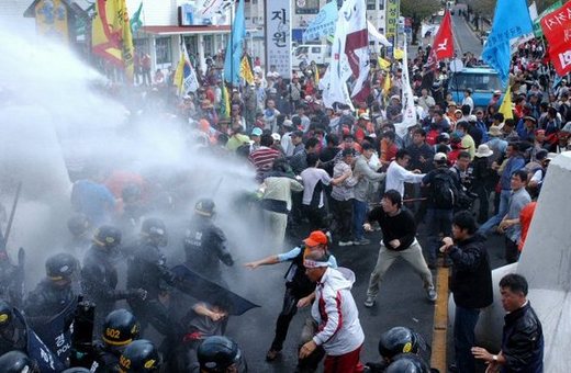
 Water cannon to protesters: South Korean riot police spray waters to disperse protesters during an anti-FTA rally in Sogwipo, a city at the southern tip of Cheju, South Korea, Tuesday.


 太政官決定前の1875年に日本の陸軍参謀局が作製した「亜細亜東部輿地図」(国立公文書館所蔵)の複写。左上に竹島と松島の記載があるものの、現在の竹島の位置には何の記載もない/1875 map that was made before 1877 daojoukan decision. On the upper left, "takeshima" and "matsuhima are written, but there is nothing at the place of the present Dokdo/Takeshima